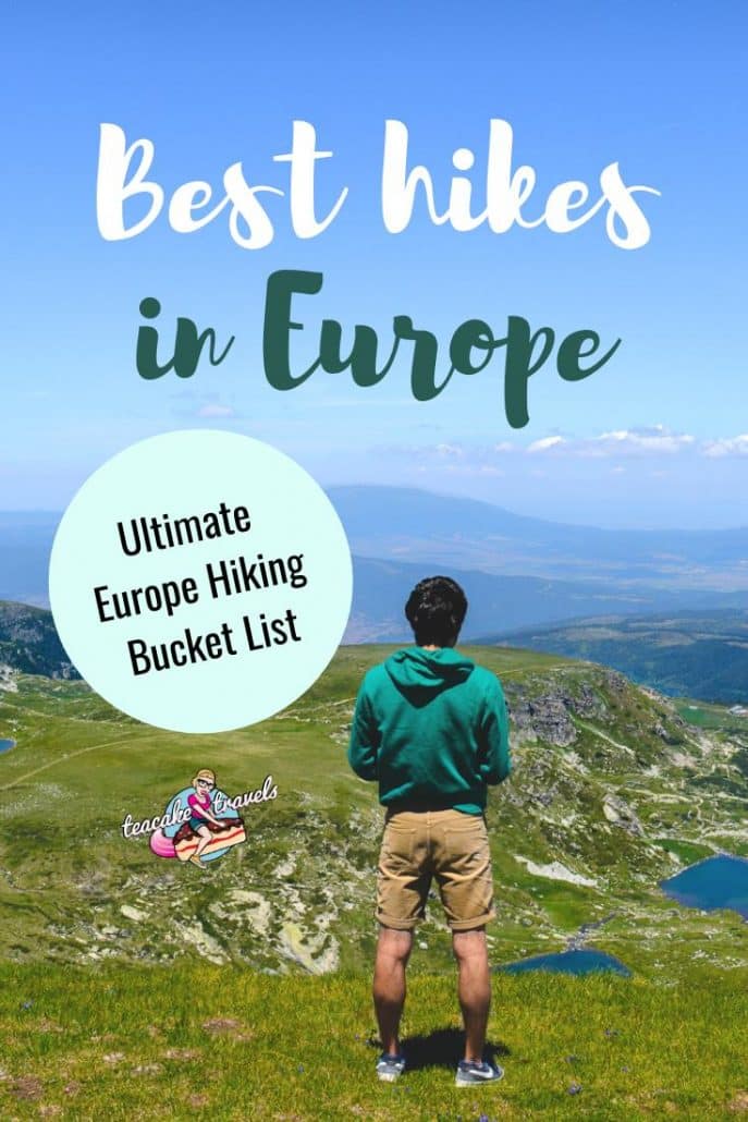
18 Best Hikes in Europe That Need To Be On Your Bucket List

Oh hey there adventurer. Putting together a bucket list for your Europe backpacking trip are you? Europe has some of the best hikes in the world so just make sure that you do not miss these 15 best hikes in Europe!
*Updated September 2019
18 Best Hikes in Europe
Me and my travel blogging buddies have tried and tested all of these places to hike, and in our opinion, these are some of the best hiking trails in the world to get your feet on right now.
Whether you’re looking for the best day hikes in Europe or want to go all in and trek for up to 2 weeks; we’ve got you covered.
In no particular order, here’s our ultimate list of the best hiking trails Europe has to offer; with difficulty levels, timings, tantalizing explanations to convince you to go, and some top-notch essential tips.
 Trek to Rysy in the Tatra mountains Poland
Quick answers
Best hiking backpack for Europe
Best places to hike in Europe
- Italy
- UK
- Switzerland
Essential Europe Hiking Gear
- Hiking shoes
- Trekking poles
- Waterproof jacket
- Water filter bottle
- GoPro Hero 7 Black
- Solar charger
- Powerbank
- Travel Insurance! Get a quote here
How to travel around Europe
Find the cheapest and fastest routes with Omio
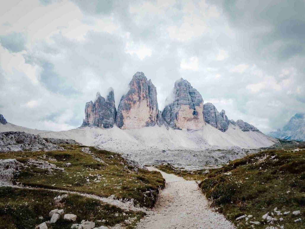
Tre Cime Natural Park Trek ♥ Dolomites ♥ Italy
Recommended by Sabrina Brett from Moon & Honey Travel
To kick off your hiking adventures, Tre Cime Natural Park (Naturpark Drei Zinnen) encompasses some of the most dramatic landscapes in the Dolomites of northeastern Italy. Rugged, yet picturesque, this park is one of Europe’s premier hiking destinations.
 Tre Cime Natural Park Trek, Dolomites, Italy
Difficulty Level
Not the best walker? This 3-day hut-to-hut hike is not technically difficult. There are no assisted climbing routes along the trail, so you don’t need to bring any via ferrata gear. If you’ve never hiked hut to hut in Europe, this is the perfect place to start.
How long it takes
While it’s certainly possible to come here for the day, I recommend devoting 3-days to Tre Cime. Throughout the park, there are several mountain huts (rifugios) you can overnight in, which makes hiking here even more enjoyable. Just make sure to make reservations well in advance. Note: camping is not permitted.
What you will see and experience
From the very beginning to the very end, you’ll be spoiled with sensational scenery. There are no boring moments, and certainly no bad views.
The trek begins in Fishleintal valley in Sexten. From Fishleintal, take the trail to the iconic mountain hut Dreizinnenhütte (Rifugio Locatelli). This Rifugio is a perfect place for lunch, as it faces the famous three peaks (Tre Cime di Lavaredo, Drei Zinnen).
For your first night, you can either overnight in Dreizinnenhütte (Rifugio Locatelli), or continue to Rifugio Lavaredo. No matter where you decide to stay, you’ll be surrounded by impressive landscapes.
On Day 2, you’ll hike the loop trail around Tre Cime di Lavaredo, and then ascend to the remote mountain hut Büllelejochhütte (Rifugio Pian di Cengia).
On Day 3, you’ll descend to Fishleintal valley.
Related Reading: 4 Day Brenta Dolomites Hiking Itinerary
Essential Tips
For trail directions and maps, read this Tre Cime di Lavaredo hiking guide.
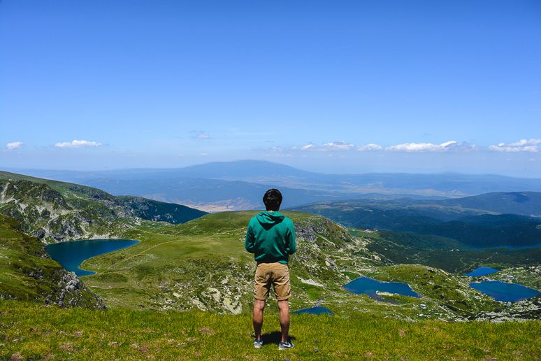
Seven Rila Lakes ♥ Bulgaria
Recommended by Maria & Rui from Two Find a Way
The Seven Rila Lakes trek is located in the Southwest of Bulgaria, right where you can find the highest mountain range in the Balkans. Bulgaria is a wonderful destination for nature lovers, as the country is filled with iconic views and countless adventures waiting for you!
This trek was absolutely one of the highlights of our Bulgaria itinerary and we hope you consider it when looking for places to go hiking in Europe.
 A view of the Seven Rila Lakes in Bulgaria Europe
Difficulty Level
Easy to hard: There are plenty of hike options at the Rila mountains, for every type of hiker. The Seven Rila Lakes trek is perfect if you are short on time or hiking experience.
New to hiking? The trek is relatively easy even if it’s your first time in the mountains. There are clear indications along the way, and even a cable car to help you start (and end) the hike.
How long it takes
Whether you want a short trek, or to explore for days, there’s certainly an option in the region for what you are looking for.
If you use the cable car, the hike will take around 2h (each way) to see all the Seven Lakes. It took us longer because we kept losing our breath due to the amazing views.
What you will see and experience
The crystal clear glacial lakes along the mountain range make for absolutely stunning landscapes!
Essential Tips
The trek is very popular among tourists, so try to get there early, and visit during the low season.
The most famous viewpoints can get crowded along the way, but if you set out a bit off the main path, you’ll have plenty of space for yourself, so that you can truly enjoy the nature around you.
Book your full day 7 Rila Lakes tour here
Pinzgau Hut Loop Hike ♥ Austria
Recommended by Lukas Saville from 10Adventures
Everyone thinks of Austria as a skiing paradise, and it definitely is. But another reason people are drawn to this country during the summer season is hiking. Located on the outskirts of Zell am See – a town which is a famous destination for adventurers and outdoor lovers – Pinzgau Hut Loop Hike is one of the finest hikes in Austria.
Some call this hike a perfect combination between the effort and the awards. It is just the right length to make it a great day out. There’s also quite a bit of elevation gain, which makes it a nice challenge, and the views after you reach the highest point on Mt Schmitten (1.965 m) are spectacular.
 Pinzgau Hut Loop Hike in Austria
Difficulty Level
The difficulty of Pinzgau Hut Loop trail is medium to hard. Even though the path is clear and wide, the distance is fairly long. There is also quite a lot elevation gain, which at times is quite intense. If you do not have trekking poles, the descend can really be exhausting and hard on your legs.
How long it takes
The Pinzgau Hut Loop hike is 14.8 Km (9.2 mi) long and you have to get through a 1.000 m (3.280 ft) of elevation gain. It should take you around 5 to 7 hours to complete this trail, depending on your fitness level and how much time you will use up for breaks and pictures. Allocate some extra time for a recharge at the Pinzgau Hut, which serves some great food!
What you will see and experience
At the start you will hike through the beautiful old forests and cascade waterfalls, climbing up until you will emerge above the treeline. You will find yourself walking parallel to the Kettingkopf (1865m) and the Kesselscharte (1844m) mountains. That creates some stunning panoramic views.
But the pinnacle point of this hike is at the end – when you reach the highest point, you are greeted with a breathtaking view of the surrounding Kaprun and the Kitzsteinhorn mountains. Mt Schmitten is actually known to be one of the best places for panoramic views in Austria.
To make your hike even better, go and grab a meal at the hut at the top – the food is wonderful!
Essential Tips
A great way to make your experience even better is to spend the night at the Pinzgauer hut. You will be able to spend the evening in a wonderful location and watch the sun setting over the Kitzsteinhorn mountain. This is a fantastic scene you don’t want to miss out on.
If you’re going to try the food at the Pinzgauer mountain hut, try the “Kasepressknödel”, or pressed cheese dumplings. It’s a delicious traditional delicacy you definitely earned after a strenuous hike.
This hike is really great for families with older kids and it’s also dog-friendly.
Tour du Mont Blanc France ♥ Italy and Switzerland
Recommended by Mags Nixon from The Family Freestylers
The Tour du Mont Blanc is one of the world’s classic high altitude multi-day treks that circles Mont Blanc, the highest mountain in Western Europe and crosses three countries – France, Italy and Switzerland.
 Tour du Mont Blanc
Difficulty Level
Difficult. This trek means business.
How long it takes
Around 11 days.
This famous 170km (105 miles) trek takes around 11 days to complete although many hikers choose to do half one year and the second half the following year, turning it into much more manageable 6 days chunks.
What you will see and experience
Boasting magnificent alpine scenery with breath taking views over the snow capped Alps, this trek is on every serious hiker’s bucket list. The trail is gruelling in places with an accumulated height gain and loss of approximately 10,000m climbing over ten mountain cols (mountain passes) and descending into seven valley floors. The height gain of the entire trail combines to a higher elevation than Everest!
Essential tips
Accommodation along the way is in charming alpine hotels along valley floors or in high altitude mountain huts (refuges) accessible only on foot.
The Tour du Mont Blanc can be hiked self guided – the trail is well marked, but note that the high mountain passes require a degree of mountain safety & good map & compass skills (in the event of bad weather).
There are many tour companies operating on the trail if self-guiding isn’t your bag. And if you can’t fit all your belongings in your day pack (max recommended weight 10kg) you can pay for your luggage to be taken from point to point.
Read more about the Tour du Mont Blanc here
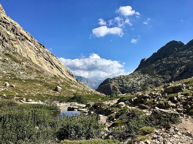
GR20 Long Distance Trek ♥ Corsica
Recommended by Christa Rolls from Expedition Wildlife
Located in the Mediterranean off the coast of southern Italy and France is the island of Corsica, home of the GR20, one of the toughest long-distance treks in Europe.
 The Corsica Mountains on the GR20 trek
Difficulty Level
Difficult! This hike should only be attempted by those who are in good physical shape, as there is serious elevation gain and loss on a daily basis, including lots of small rock climbing sections in areas with route exposure.
How long it takes
7 to 16 days.
GR20 hikers should plan for approximately 16 days to hike the entire trail, though some only hike either the North, the toughest section requiring around 9 days, or the South, the easier section requiring around 7 days.
What you will see and experience
This challenging trek takes hikers through rolling hills, up to stunning mountain vistas, and along flowing streams throughout their journey.
Everything in Corsica is very uniquely Corsican, including the language, food, and music, so the cultural experience of this trek is exciting for those looking for something entirely new.
Essential Tips
Take rest days as needed, and plan to carry as little as possible to reduce backpack load – refuges at each stop offer beds and meals, along with a functioning kitchen.
Most of all, have fun meeting wonderful people in this stunning part of the world! Take some time after the hike to explore destinations such as the beaches of Port-Vecchio and the wine region outside Bastia.
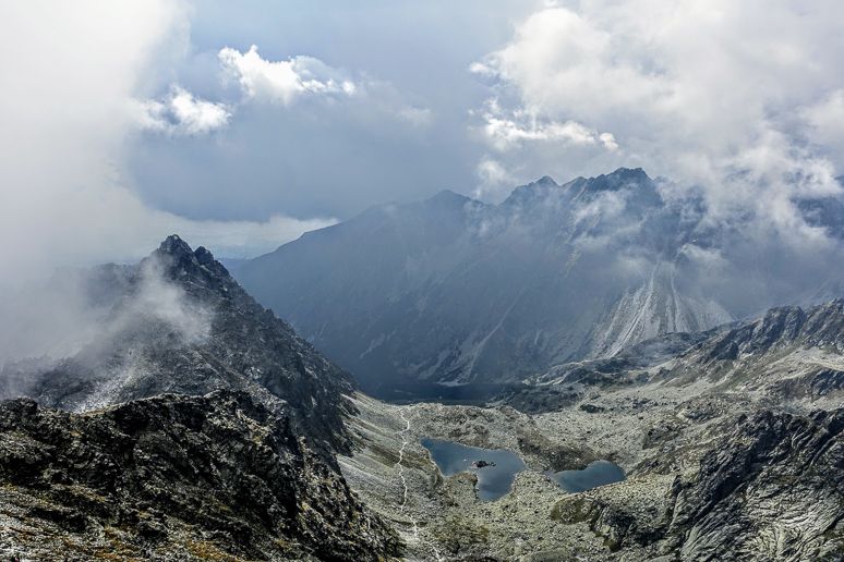
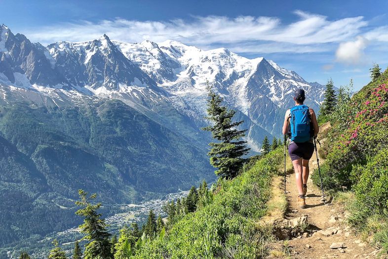
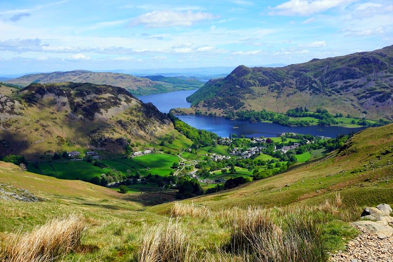
Rysy trek ♥ Poland
Recommended by Joanna Dąbrowska from Over Here
Rysy is one of the best places to go hiking in Poland as it’s the highest mountain there: it reaches 2499 metres! Located in High Tatra range in the south of Poland, this trek is famous for its spectacular views and exciting trail. To be precise, Rysy is not just one peak which reaches 2499 metres. Rysy is actually a mountain massif which consists of three peaks. The highest one reaches 2503 metres and belongs to Slovakia (together with the lowest peak which reaches 2473 metres).
Trek to Rysy in the Tatra mountains Poland
Difficulty Level
Not for beginners!
The trail is long and there is a lot of height differences to trek throughout. Good physical condition is necessary!
How long it takes
Getting to the peak from the parking lot takes about 6-7 hours (this does not include the descent).
What you will see and experience
The trek to Rysy is very popular, especially in the summer, when there is no snow and ice on the trail. Hikers like this route for a few reasons: it is the highest mount in Poland, it is one of the most scenic trails, and the trail starts at the most popular place in the Tatra mountains – Morskie Oko lake.
The trek is beautiful because of the dramatic landscape of the High Tatras where impressive granite rocks soar towards the sky. You will also get to admire two awe-inspiring post-glacial lakes on your way. The first one is Morskie Oko and the second one is Czarny Staw Pod Rysami. Both are the perfect place to catch a breath and contemplate the amazing nature of the Tatra mountains.
Essential Tips
There are chains in the upper part of the trek and significant exposure to the elements. Rysy is definitely not suitable for you if you have a fear of heights.
The trail tends to get crowded in the summer. It not only decreases the joy of admiring the mountain landscape, but it also makes climbing harder. Try and visit outside of this time!
The climb down can be done on the same route back to Poland, or hikers can choose the easier option and descend to Štrbské Pleso in Slovakia.
Find out more about the Rysy trek here
Snowdonia ♥ Wales ♥ UK
Recommended by Ryazan Tristram from Everything Zany
Trekking the Mount Snowdon in Snowdonia National Park in Wales, UK is one of the best mountains to hike within the British Isles. Mount Snowdon is the highest peak in Wales (1085m) and the 2nd highest in the UK next to Ben Nevis (1345m)!
According to the local folklore, Mount Snowdon is the burial place of the giant Ogre Rita that was defeated by King Arthur.
Mount Snowdon has been a part of the popular hiking challenge in the UK called the National Three Peaks Challenge wherein the participants will trek the 3 highest peaks (Ben Nevis, Snowdon and Scafell Pike) in the UK within 24 hours to raise money of their chosen charities.
 Snowdonia, UK
Difficulty Level
There are 8 different paths up to Snowdonia. From most difficult to the easiest they are: Crib Goch, The Watkin Path, Snowdon South Ridge, Snowdon PYG Track, Rhyd Ddu Path, Miner’s Track, Snowdon Ranger Path and finally the Llanberis Path.
How long it takes
I have conquered the summit of Mount Snowdon twice now, taking the two popular hiking paths to the summit. With the Miner’s Path it’s 3 hours to the summit. With the Llanberis, it’s 3 to 5 hours to the summit.
The Snowdon mountain railway is also available to reach the summit for people who prefer the easier and far more accessible route.
What you will see and experience
On your ascent to the summit, you will see the rugged green landscape of the whole Snowdonia National Park. Various rock formations, terrains, waterfalls, streams and lakes can also be seen depending on which of the six paths to the summit you will take.
Essential Tips
Don’t forget to bring your waterproof jacket on your trek. Welsh weather is so unpredictable and the summit can be so cold due to its altitude!
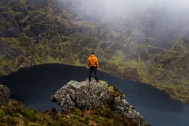
Coumshingaun Lake Loop ♥ Waterford ♥ Ireland
Recommended by Conor Phelan from Your Irish Adventure
Not every trek has to be an epic summit, where you camp, deal with high altitude or worry about your water supply. Some of the most beautiful hikes in the world are simple loop walks. There’s something very satisfying about completing a loop. They give a sense of closure at the end. You’ve completed something.
The Coumshingaun Lake loop is, in my opinion, one of the best walks in Europe with just the right length and difficulty!
 The Coumshingaun Lake Loop in Waterford, Ireland – Photo courtesy of Your Irish Adventure
Difficulty Level
Moderate: It’s pretty unrelentingly steep on the way up and down, so if you bring a heavy pack, it’ll help prepare you for tougher multi-day treks. It’s also great for people with a little hiking experience who want to move on to the next level and push themselves.
How long it takes
The whole loop should only take about 4 hours but can be done in less than three if you are an experienced trekker.
What you will see and experience
When you leave the car park, follow the trail to a small stile/gate and on to the bottom of the lake. You can choose to follow the ridge around to the left or the right: I prefer the left side as the slope is slightly less steep on the right and makes for an easier descent. There isn’t much to know about this route in advance, but if you get a clear day the views of the lake below are stunning. It can be windy, but the ridge is wide and has walkable terrain both sides of the ridge which offer good protection.
Essential Tips
Along the top can be very wet and boggy underfoot, so take care.
It is a steep drop down into the valley, so be careful to stay away from the edge as you will be fully exposed to the elements on the flat.
Carros de Foc ♥ The Pyrenees ♥ Spain
Recommended by Gábor Kovács from Surfing the Planet
Looking for good hiking spaces in Spain? Spain is home to many beautiful mountainous areas, but probably the Pyrenees is the most famous for its infinite possibilities for mountain adventures. Amongst the different treks available here, the Carros de Foc Trail in the Aigüestortes i Estany de Sant Maurici National Park is the most exquisite!
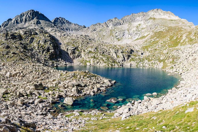 The Carros de Foc in the Spanish Pyrenees
Difficulty Level
Medium to Hard: depending on how much or little you decide to tackle!
How long it takes
Carros de Foc is a 56km long circular trek that goes through the most beautiful part of the latter national park. You can do the full trek in 5 to 7 days or you can do a smaller section. How about taking on a circular version of the Carros de Foc in 3 days, during which you can sleep in fully equipped mountain refuges.
What you will see and experience
The landscape throughout the whole trek is very varied and there are no monotonous segments at all. The trail starts from the village of Espot and climbs up through a dense pine forest till the first refuge house, situated near a beautiful lake. The view of sunrise over the lake is simply unforgettable.
The second day of the trek goes through a mountain pass (Collado de Monestero) and some elevation, but the always-changing views of different pristine alpine lakes of all sorts of colors are more than enough compensation for the effort!
On the second night, you can spend your time in a mountain refuge near the Amitges Lake, whilst the third day is an easy downhill walk.
Essential tips
The refuge houses offer abundant breakfast and dinner options, so you don’t need to carry too much weight in your rucksack if your dietary needs are flexible.
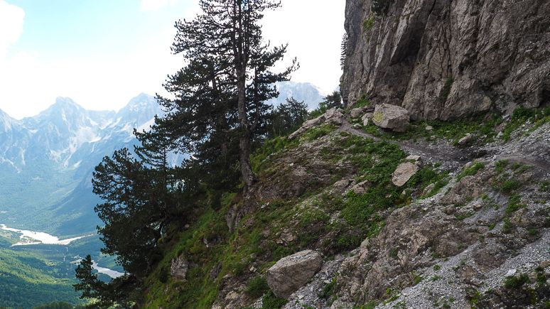
Valbona to Theth ♥ Accursed Mountains ♥ Albania
Recommended by Alejandro Nuñez from Mi Viaje por el Mundo
When people think of travelling to Europe, Albania usually isn’t a country that comes to mind, which is why it is such a great destination, full of great trek opportunities and good hiking trails.
There are so many things to see and do in Albania including multiple towns that are deemed UNESCO World Heritage Sites, museums dedicated to the country’s tumultuous past, beautiful and undeveloped beaches, and of course, the Accursed Mountains!
The most popular hike in Albania is set in the Accursed Mountains, between the tiny towns of Valbona and Theth.
 Valbona to Theth in Albania
Difficulty Level
No experience is required, and the trail is well marked, but it does require moderate physical exertion.
How long it takes
The entire excursion requires 2-3 days and 2 nights. It takes most people between 7 and 10 hours to complete the trek in total. The trek itself is about 12 km long reaching a maximum altitude of 1815m and a minimum altitude of 800m.
What you will see and experience
This three-day trek will take hikers right over the mountains on a trail that was originally used only by locals to transport goods and merchandise from one town to the next. It’s still used for this purpose today as there are no roads that connect these towns. On any given day you’re sure to be passed by some local with a mule or two loaded up with goods for transport.
The first day, you’ll take various forms of transportation, including a ferry across the beautiful Lake Koman to Valbona and spend the night there. On the second day you’ll trek over the mountains to Theth. You’ll spend the second night in Theth and head back on the third day.
Essential Tips
As tourists have discovered this path, some infrastructure has been put in place to capitalize on the influx of travellers. There are two crude but cute coffee huts along the path where you can stop for a caffeine fix or a cold drink that’s been chilled in icy mountain spring water. There are also homestays and guesthouses in both towns, all run by locals and include homemade meals.
Transportation and lodging are easiest to organize once in Albania as many of the accommodations don’t have Internet. Your departure point will be the city of Shkoder, near the border with Montenegro. Once there you can organize everything through your hotel or hostel. Most will also allow you to leave your luggage with them until you return from the hike.
Take only a small pack with essentials for 2 days and 2 nights, as you’ll be carrying this with you on your hike between Valbona and Theth.
Don’t forget to bring a camera because the landscape is stunning all the way along! I recommend the latest GoPro Hero Black 7 for stunning landscape and action shots.
Check out this epic 6 day Albanian Alps Hiking Tour
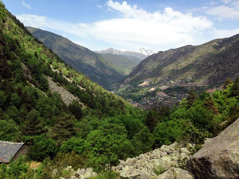
Vall del Madriu-Perafita-Claror hike ♥ Andorra
Recommended by Halef from The Round The World Guys
While you have many options for exploring the world famous Pyranees region, don’t miss the Madriu-Perafita-Claror Valley for its distinctive beauty when trekking Europe! The Vall del Madriu-Perafita-Claror is in the tiny country of Andorra, sandwiched between its massive neighbors, Spain and France. Although the country is well-known as a shopping mecca for cheap luxury goods and winter activities, it also offers several good hiking routes. The Madriu-Perafita-Claror hike is one of the top things to do here.
 Vall del Madriu-Perafita-Claror in Andorra
Difficulty Level
Easy to hard depending on whether you want to be here for a few hours or for quite a few days!
How long it takes
There are many different suggested itineraries, anything from a few hours of hiking to multi-day journeys.
What you will see and experience
This hike cuts through a valley which became a UNESCO World Heritage Site in 2004. The Vall del Madriu-Perafita-Claror is a Cultural Landscape of Andorra. You can find its trail head in the Escaldes-Engordany, about a 10-minute walk from the Andorra la Vella town center.
No matter which itinerary you choose, you’ll get some of the best views the Pyranees Mountains can offer. You’ll see breathtaking landscapes, dotted stone shepherd cabins and huts, and you can also meet several friendly four-legged residents that graze in a nearby pastures.
Even better, once you get back to Andorra la Vella, the capital city, you can immerse yourself in city life, shopping, and dining. Don’t miss the famous Caldea Spa: great treatment and sauna rooms are available in this legendary 18-floor spa resort!
Essential Tips
A unique thing to do here is to visit the unique Andorra post offices once you’re back on the ground. They use both French and Spanish postal systems. You can purchase a stamp to add to your travel journal. It’s a unique travel journal idea that I do everywhere I travel.
Check out this premium Andorra trekking experience
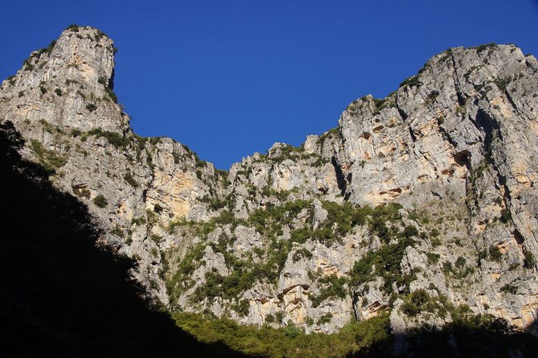
Vikos Gorge hike ♥ Zagorohoria ♥ Greece
Recommended by Wendy Werneth from The Nomadic Vegan
The Vikos Gorge hike in the Zagorohoria region of northwestern Greece is my pick for the best trek in the world because of its spectacular scenery! Vikos holds the Guinness Book of World Records title as the world’s deepest gorge, and walking inside it is a humbling and awe-inspiring experience.
Unlike the more famous Samaria Gorge on Crete, which gets as many as 3,000 visitors per day in the peak season, this gorge is largely unknown among tourists. You will be able to enjoy the scenery in peace and quiet and experience authentic rural life in Greece.
 Vikos Gorge in Greece
Difficulty Level
The route is a bit more difficult than the Samaria Gorge trek, but it’s worth the effort for the spectacular views when gazing up at the sheer cliffs from down below.
How long it takes
The trek takes about 6-7 hours.
What you will see and experience
The starting point for the trek is a small mountain village called Monodendri. The trek ends at the picturesque village of Mikro Papingo, a small cluster of houses with stone walls and slate roofs perched on the side of a mountain.
Essential Tips
There is a bus that goes to the village, but make sure the bus driver knows where you want to get off! In these rural areas, English is not as widely spoken as it is in Greek cities. We had a few communication problems but got to Monodendri eventually.
Bring some hiking snacks with you! Monodendri doesn’t have much in the way of supplies.
Book your one day Vikos Gorge hike here
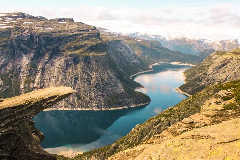
Trolltunga ♥ Norway
Recommended by Claire Stokes from Stoked To Travel
Of all the famous hiking trails in the world, Trolltunga in Western Norway has become one of the world’s most popular hiking destinations. This is mostly because of the incredible protruding rock known as the “troll’s tongue” which offers some epic photo-taking opportunities!
This being said, this Norway trek is no walk in the park and it’s easy to get it wrong.
 Trolltunga, Norway
Difficulty Level
Difficult!
How long it takes
The entire route is 23km in distance, which although isn’t too far, it has an ascent of 1000m in the first kilometre and the terrain is tough and demanding. In fact, it can take on average 10-12 hours to complete this return trip!
What you will see and experience
The views are incredible as the route winds its way along fjords, each corner offering another spectacular vista across twinkly blue waters and stunning cliff drops. Make sure to enjoy a picnic at the troll’s tongue – easily one of the most beautiful spots in the world.
Essential Tips
This super scenic route can only be accessed from late May to mid-September, although you could tackle the hike in snow shoes with a local company if you wanted to go in the winter months.
People often don’t complete this hike and get stranded mid-route if they start too late in the day and helicopter rescues are increasingly frequent. Be prepared.
Bring all of your own food (there’s certainly nothing on the route)
Book your overnight hike to Trolltunga here
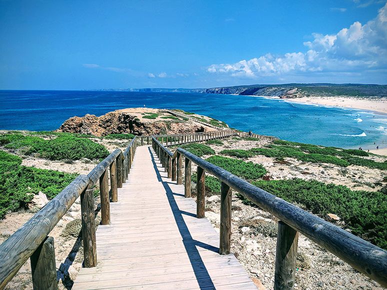
Rota Vicentina ♥ Portugal
Recommended by James Cave from Portugalist
The Rota Vicentina stretches for more than 450 km along the Southwest of Portugal and is one of Portugal’s most beautiful walks. Although it has been officially open since 2012, the route is still relatively unknown amongst walkers – which is a good reason to prioritise it for your next trip!
Regardless of which section you walk, or how many days you walking the trail, you can be certain this is a trip you’re going to be remembering on your hiking destinations list for a long time to come.
 Rota Vicentina in Portugal
Difficulty Level
Not bad at all! It’s relatively easy; it’s just the distance you choose to walk that will be the challenge. The Fishermen’s Trail is not recommended for those who have vertigo or fear of heights.
How long it takes
0.5 days to 16 days: It really depends on what circuits, sections and routes you want to take.
The Fisherman’s Trail, for example, is broken up into 5 sections and 4 complementary circuits and is 125 km in length. The Historical Way, similarly, is a walking holiday in itself and comprises of 12 sections totaling 230 km in length.
A section usually equates to a day of walking but, if you only have a limited amount of time, it is possible to walk more than one section in a day. Most people don’t have the time to do all 450 km and usually just complete one of the main trails.
What you will see and experience
The full walk is made up of 2 main trails, the Fisherman’s Trail and the Historical Way, as well as 8 circular walks. Between the different stages, the Rota Vicentina takes you through an ever-changing landscape of rugged cliffs, beautiful sandy beaches, forests, and fields of wild flowers.
Essential Tips
Although you can walk the Rota Vicentina any time of year, spring is usually the best time of year for it. As this is the off-season on the Algarve, accommodation will be cheaper, and the weather will be much more suited to hiking.
Book your epic coastal Alentejo and Rota Vicentina Walk Tour here
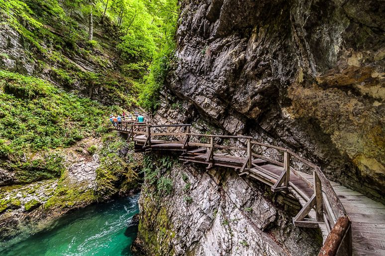
Vintgar Gorge ♥ Slovenia
Recommended by Leo from Safari Nomad
One of the most popular trails in the vicinity of Slovenia’s most iconic destination of Lake Bled is Vintgar Gorge. Are you looking for good walks in Europe more than a hike? Then this is simply magical and for good reasons…
 Vintgar Gorge in Slovenia
Difficulty Level
Easy. The trail is only about a mile in length, very easy to walk and suitable for anyone.
How long it takes
The walk takes under one hour.
What you will see and experience
Vintgar Gorge is located in the eastern edge of the Triglav National Park, just a few miles outside of the town of Bled. Carved out by the Radovna river, the gorge is surrounded by greenery and lovely wooden walkways and bridges installed bellow impressive vertical cliffs. The river is rushing and roaring and the canyon is narrow. The color of the water changes from green to blue depending on the section. Moreover, the water is transparent forming beautiful pools, rapids, and waterfalls!
The highlight you will spot at the end of the trail is the mighty 42 foot high Šum waterfall. It’s Slovenia’s highest river waterfall! There you will also see the single-arch stone bridge of the Bohinj Railway crossing the gorge above, offering spectacular view.
Essential Tips
At the entrance you will need to pay the admission fee (4 eur). You can get discounts for kids.
The gorge is open from May to October.
The best time to visit is in the morning when there’s no crowds.
Find out more about Vintgar Gorge here
Try out this hike in Bela Krajina too
Skåneleden Trail ♥ Sweden
Recommended by Alexander Waltner from Destinavo
There are several hikes in Sweden, but most of them are in the Northern part of the country. However, in the South there is one trek that certainly stands out and offer amazing views and scenery, and that’s the trail called – Skåneleden. It’s one of my best hiking destinations.
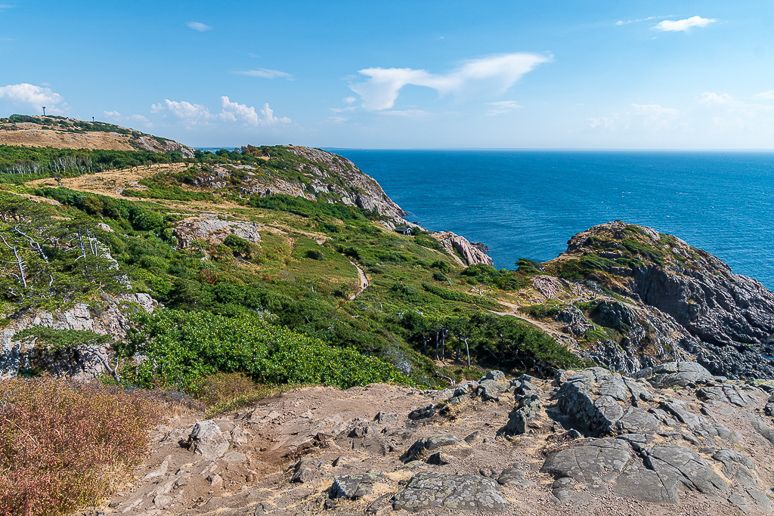 Kullaberg on Skåneleden in Sweden
Difficulty Level
The terrain is fairly easy, and most trails are easy to moderate with other side parts where you can walk on a tougher level if you wish.
How long it takes
As long as you want! With so many choices you can complete many day hikes (there are 95 of them) or stay overnight and join what treks you want together.
What you will see and experience
Skåneleden crosses all of the Southern region of Skåne, from West to East and North to South. There are several trails on this trek and some are doable in one day, while some require overnight in a tent or a guesthouse along the way. There’s deep dark forests, impressive monuments, beautiful fields and so much more. The total length of Skåneleden is 1250 km, and this will take you through all of the stunning nature and cultural places of Skåne. You can choose any of the 5 trails to start with.
Essential Tips
I recommend bringing:
- a good pair of walking shoes
- a rainjacket
- a reusable water filter bottle
The tourism board of Skåne takes care of the trail year round, and along the way there are windhuts available for overnight. Along the coast it can get pretty windy at times, so these are great to stay in.
The best time to walk this trail is in summer or autumn, but late spring is also enjoyable.
There are plenty of places to fill up your bottle, and the river/stream water is very pure.
Find out everything you need to know about the trek here
Helvellyn ♥ England ♥ UK
Recommended by Lukas Saville from 10Adventures
Even though Helvellyn is not the highest mountain in England and does not even classify as a high mountain in general (950 m), it’s probably the most popular hiking destination in the magical Lake District National Park.
The Helvellyn hike via Striding and Swirral Edge is a challenging hike, or fell-walk, as they call it in the UK. It involves steep slopes, difficult ascents and even scrambling. So you will have to get your hands dirty.
But the effort is worth it. The trail takes you from the beautiful and picturesque town of Glenridding up onto the Helvellyn mountain range, where you will be surrounded by the stunning views of the Lake District. And on a clear day, you can even see the Irish Sea!
 On the ascent of Helvellyn
Difficulty Level
It’s a strenuous hike, mainly because of the high elevation gain within a fairly short distance. It also involves scrambling up the Striding Edge and down the Swirral Edge, which can be too difficult for an inexperienced hiker. There have been fatal accidents on this trail, so I really recommend to take care and only do this hike if you are in a good physical condition.
How long it takes
The Helvellyn via Striding and Swirral Edge hike is a 12.9 Km (8.0 mi) trail with approximately 842 m (2.762 ft) of elevation gain. The whole circular hike can usually take around 5:30 to 7 hours to complete. It depends on your fitness level, the number of breaks and time you spend enjoying the lookouts.
What you will see and experience
The Helvellyn hike is an amazing opportunity to experience everything the famous Lake District has to offer. While walking on the Helvellyn mountain range you will enjoy breathtaking views of the surrounding mountains, farms, and quintessential British villages. and beautiful lakes.
You will have great views of the beautiful lakes of Thirlmere and Ullswater. You will walk by the cute mountain tarns and green valleys, home of the free-roaming sheep. On a sunny day, you can even see the Irish Sea and the Southern Fells mountain range and its highest mountain in England – Scafell Pike.
If you’re lucky, you might also spot fighter jets flying low between the mountains, right by the Helvellyn mountain range. These are the Royal British Airforce in training – a truly incredible sight.
Essential Tips
After the hike, visit one of Glenridding’s local inns and enjoy a traditional English ale and a hearty traditional meal.
I recommend avoiding this trail if the weather is bad. There’s quite a bit of scrambling involved and the rocks become slippery.
Make sure you have waterproof hiking boots as the Lake District is known for its water streams and parts of the trail can become wet.
Lauterbrunnen to Schilthorn ♥ Switzerland
Recommended by Gigi Griffis from Vicious Foodie
If you’re looking for a short trek that showcases a little of everything whilst hiking in the alps, you can’t do better than the trail from the valley floor of Lauterbrunnen to the above-the-tree-line peak of Schilthorn. It’s one of the best hikes in Switzerland!
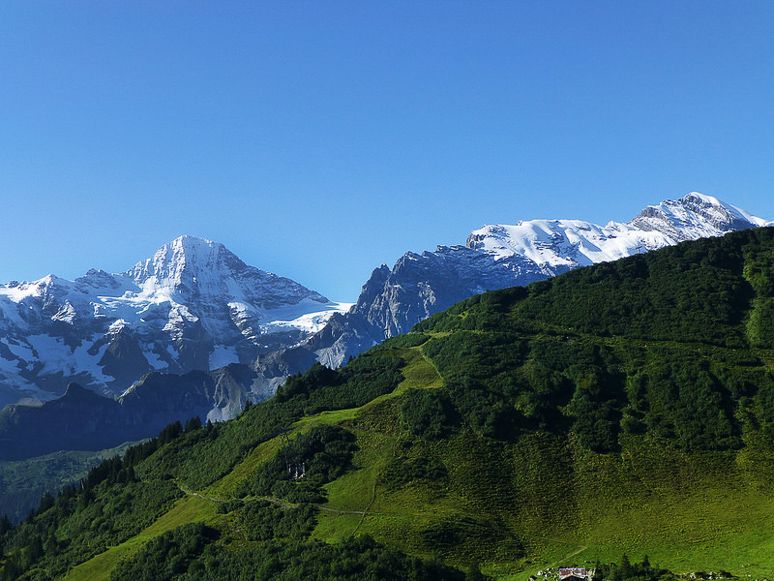 Lauterbrunnen to Schilthorne trek in Switzerland
Difficulty Level
Moderate.
How long it takes
One way, the hike takes over 7 hours and gains over 5,000 feet of elevation, so it’s worth staying overnight at least one night in one of the mountain huts (or committing to a very long trek up and then taking the series of cable cars down or vice versa).
What you will see and experience
Start in Lauterbrunnen—a valley known for its 72 waterfalls and its role as the inspiration for Tolkein’s Rivendell—and follow the trail signs across from the train station toward the town of Mürren. The path is steep and draped in shady, quiet woodlands until you emerge atop the cliffs for a more leisurely walk along the cliffs with views of the region’s tallest peaks looming across the valley.
From there, signs will lead you to Schilthorne along one of two paths. The prettier is the one that heads toward rotstockhutte then Bryndli then Birg and finally Schilthorn.
The rest of the trek is a study in contrasts—snow-capped peaks high above, fields bursting with wildflowers under your feet, dizzying ridges with steep slides down either side, and cold, blue Alpine lakes ringed with grazing sheep.
Essential Tips
When you reach the peak, you’ll find a 360-degree rotating restaurant with views on a clear day that they say go all the way to the French Alps. Grab a seat by the window and try some Swiss specialties while admiring the view!
Just want the cable car? Book your ticket here.
Are these the best hikes in Europe?
With so many best trekking places to choose from, we bet we’ve missed your favourite off!
Comment Below
Comment below with your best treks in Europe. Tell me what European long distance paths you’ve spotted or conquered, or what great day hike you’re planning next! Can’t wait to read your suggestions below to discover more great hikes and be inspired!
Related Reading
How To Hike The Stunning Ladder of Kotor Hike in 4 Easy Hours
Hiking El Caminito del Rey: one of the best hikes in Spain
Cinque Terre: one of the best hikes in Italy
12 Reasons To Visit The Beskydy Mountains Czech Republic
Join the conversation
5 Comments
Gemma5 March 2019
Fantastic list! The trolltunga in Norway has long been a place I'd love to hike! I've managed Snowdon and part of the Pyrenees, including some in Andorra. I'm living in New Zealand now though so my future hiking will be predominantly here!
Alice Teacake5 March 2019
Hey Gemma. Glad you're digging the list! The good news is that the New Zealand bucket list is coming right up too. Watch this space :)
Traveler6 May 2019
I absolutely love this post! You have been doing this for a LONGGGG time and I love all the wonderful tips you share! I hope to travel as far and as often as you! Such an inspiration, thanks
Alice Teacake29 May 2019
Yesssss it's great to hear your enthusiasm and passion for travel! Travel is the best :D Keep exploring x
Antonio28 October 2021
A great post. Congratulations! I knew some routes and some I did not. Without a doubt, all the ones you have written that I know deserve to be there. Of them, I really liked the one that goes from Valbona to Theth, especially since I did it on a time when there were few walkers. From Slovenia I would add some from the Soca Valley, although there are so many trails there ... I have been spoken highly of the Seven Rila Lakes, although I have not yet had a chance to go. I have it signed up for a next trip. Good luck and many trips!
Comments are closed.